To make a map that represents the features of a cave in a sufficiently realistic format to be useable for these purposes, true measurement by use of surveying techniques is generally required. Even a low quality map produced by crude survey methods is usually more useful than a detailed sketch map made purely from memory or even on-the-spot. Unfortunately, traditional surface survey techniques are not usually appropriate for caves, due to the lack of visible external reference points and the cost and weight of the instruments needed.
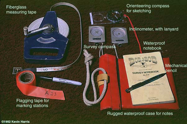
Fortunately, unlike radio waves, most of which are strongly absorbed by the rock in most cave regions, the direction of the earth's magnetic field is unaffected by the surrounding rock of a cave passage. Indeed, it is embedded in that very rock! This means that angle measurements using precise hand-held compasses work very well underground. These small, robust instruments, together with a long reel of fiberglass measuring tape, a means of marking survey points, and a pad of specially formatted and treated paper for note taking, are the mainstays of the surveyors' toolbag.
Errors of less than 2% are possible when good measurement techniques are used and the instruments are calibrated for periodic variation in the earth's magnetic field.
| | Basic cave surveying tools |
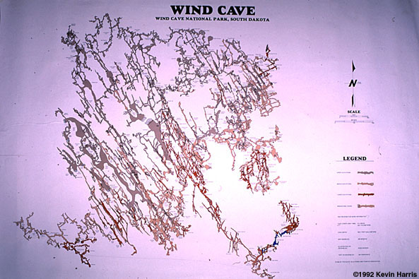
| | A finished cave map can be very useful in planning exploration trips and scientific study. Why, for example, do most of the passages run in two general directions? |
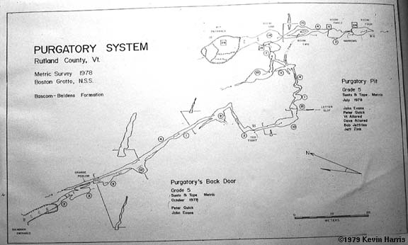
| | This is a map of Purgatory Pit in Vermont. |
Page Maintained by: